

How to measure lawn square footage online
Find your lawn’s square footage for seeding, sod or mowing. Trace the grass on a satellite map, leaving out the parts you won’t work on.
Find the lawn you want to measure
Search your US address and select the matching result. On the satellite map, zoom until you can follow the grass beside the house, driveway, walks, and planting beds. Keep the whole section you’re about to draw in view.
For whole-lawn seeding or mowing, include the front, side, and back lawns. For a repair, measure just the patch. Lot size is not lawn size: buildings, pavement, pools, and beds stay outside your lawn measurements.
Draw and finish
Choose a tool, then click or tap along the grass edge. Draw separate, non-overlapping sections around driveways, walks and beds so you count only the lawn.
Freeform
For irregular areas, click or tap around the edge in order. Use at least three points, adding more to follow curves. Choose the Finish drawing checkmark to close the area.
Rectangle
For rectangular areas, click or tap two opposite corners. The measurement finishes automatically.
Distance
Click or tap two points to measure a straight line, such as a border or wall run. Distance returns length only; it never enters an area total.
Undo last change
Remove the last point you placed and try again.
Cancel drawing
Discard the unfinished drawing. Your completed measurements stay on the map.
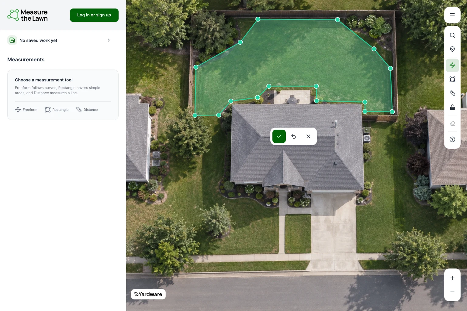
Adjust the lawn edge
Move a corner
Select the measurement on the map, then drag a corner onto the grass edge. The area updates as you move it.
Edit measurement points
To add a point, choose Edit measurement points and drag a smaller handle between two corners. Finish with the checkmark.
While editing, Undo reverses your last change. Cancel restores the measurement from before editing.
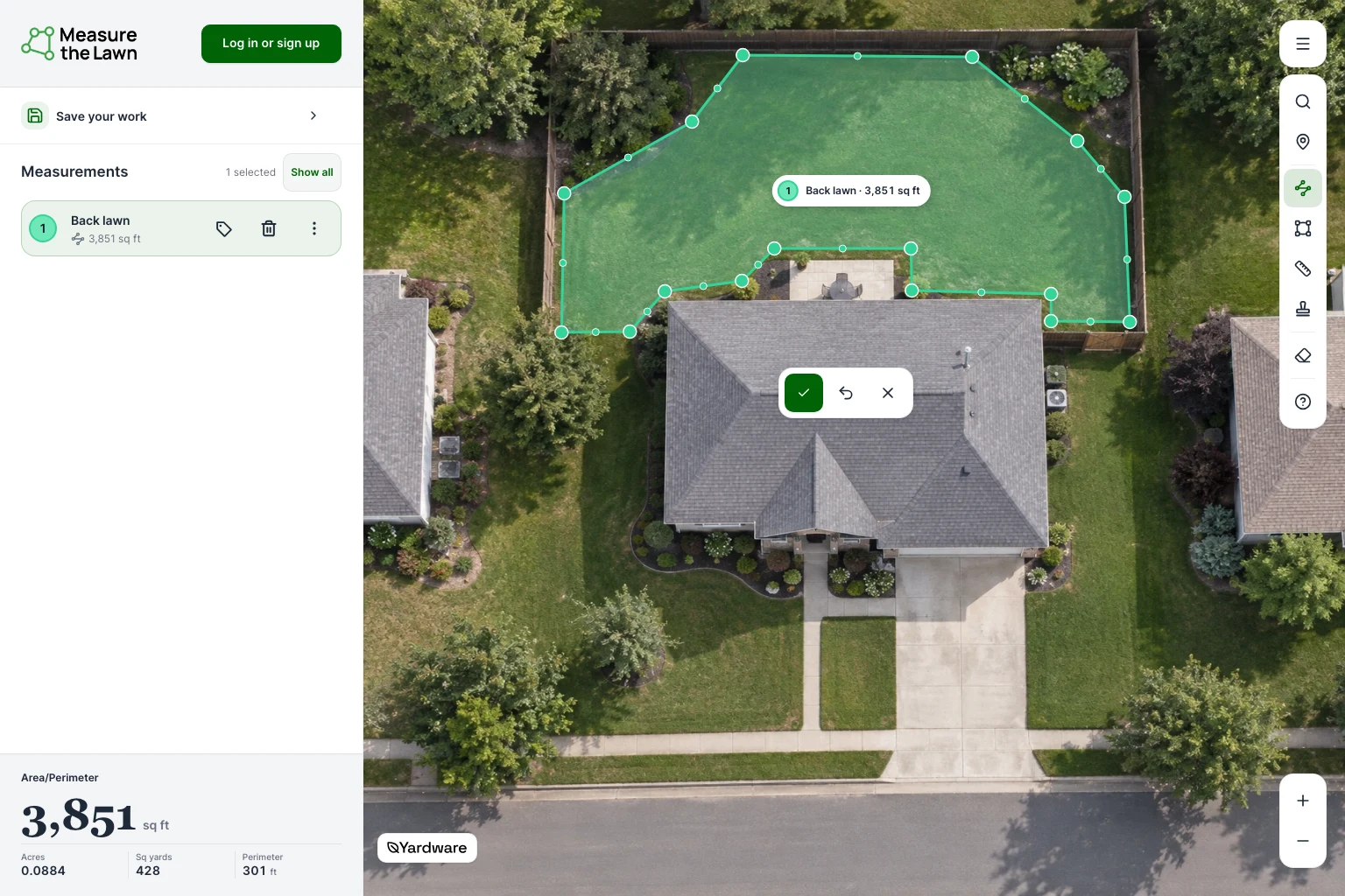
Name and color-code the sections
On phones and tablets, open Measurements at the bottom of the map.
Rename
In Measurements, choose Rename beside an area. Enter a name such as Front lawn or Back lawn.
Color measurement
Select an area on the map, then choose Color measurement. Keep its name so you can identify it without color.
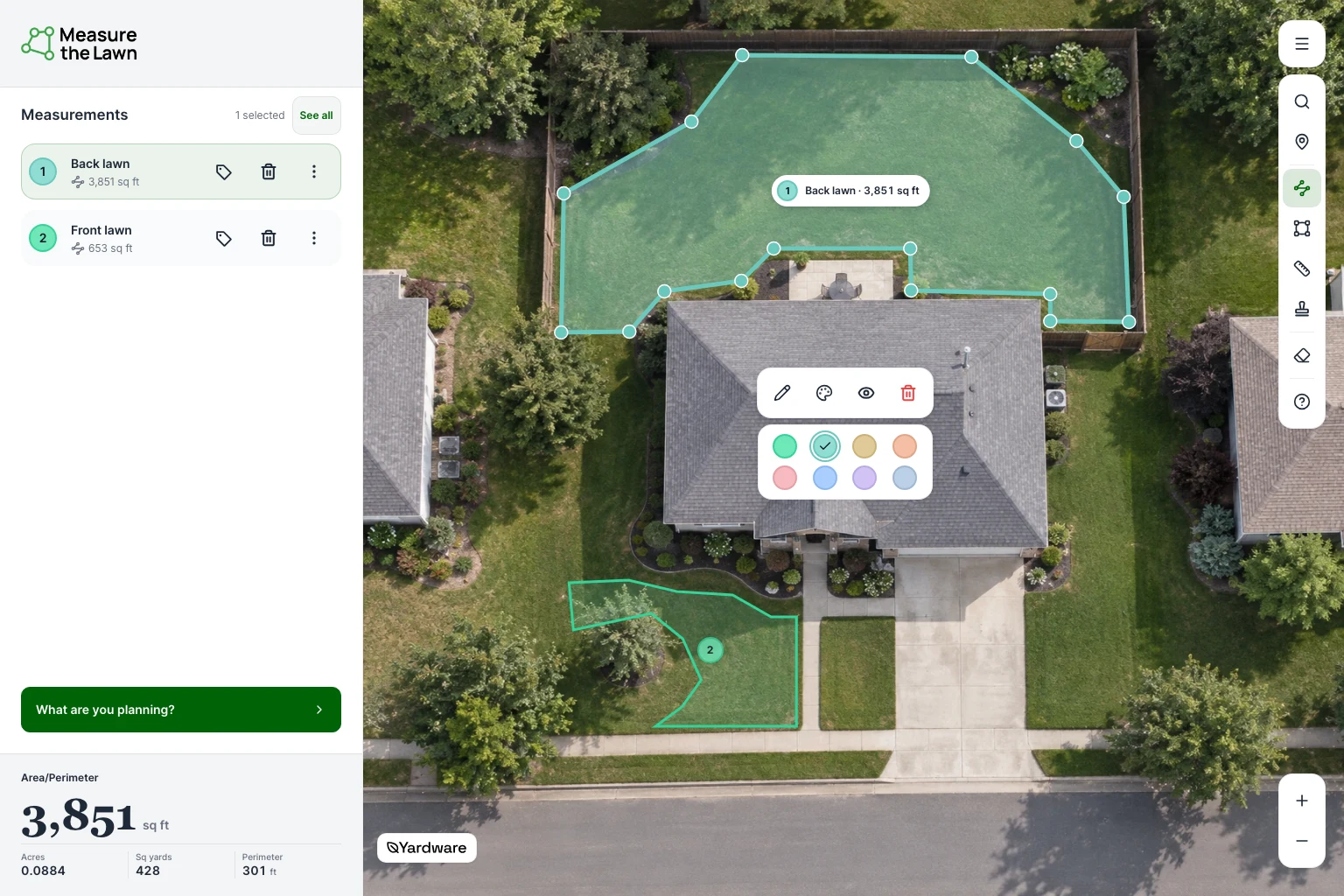
Mark useful details
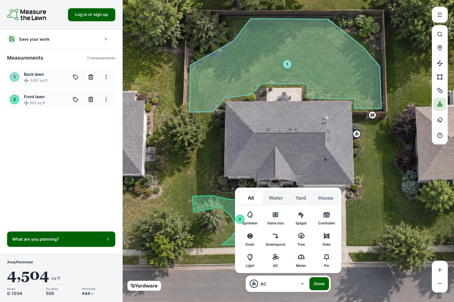
Remember a gate for mower access, an AC unit to work around or sprinklers to avoid. Marks don’t change your area or material quantities.
Add Marks
When available, choose Add Marks, pick a feature and click or tap its location. Choose Done when you’ve finished placing Marks.
Update a Mark
Select a Mark on the map to move, rename or delete it.
Put the measurements to work
In Measurements, select a lawn section for its area and perimeter, or choose See all for combined totals. Hidden measurements are left out.
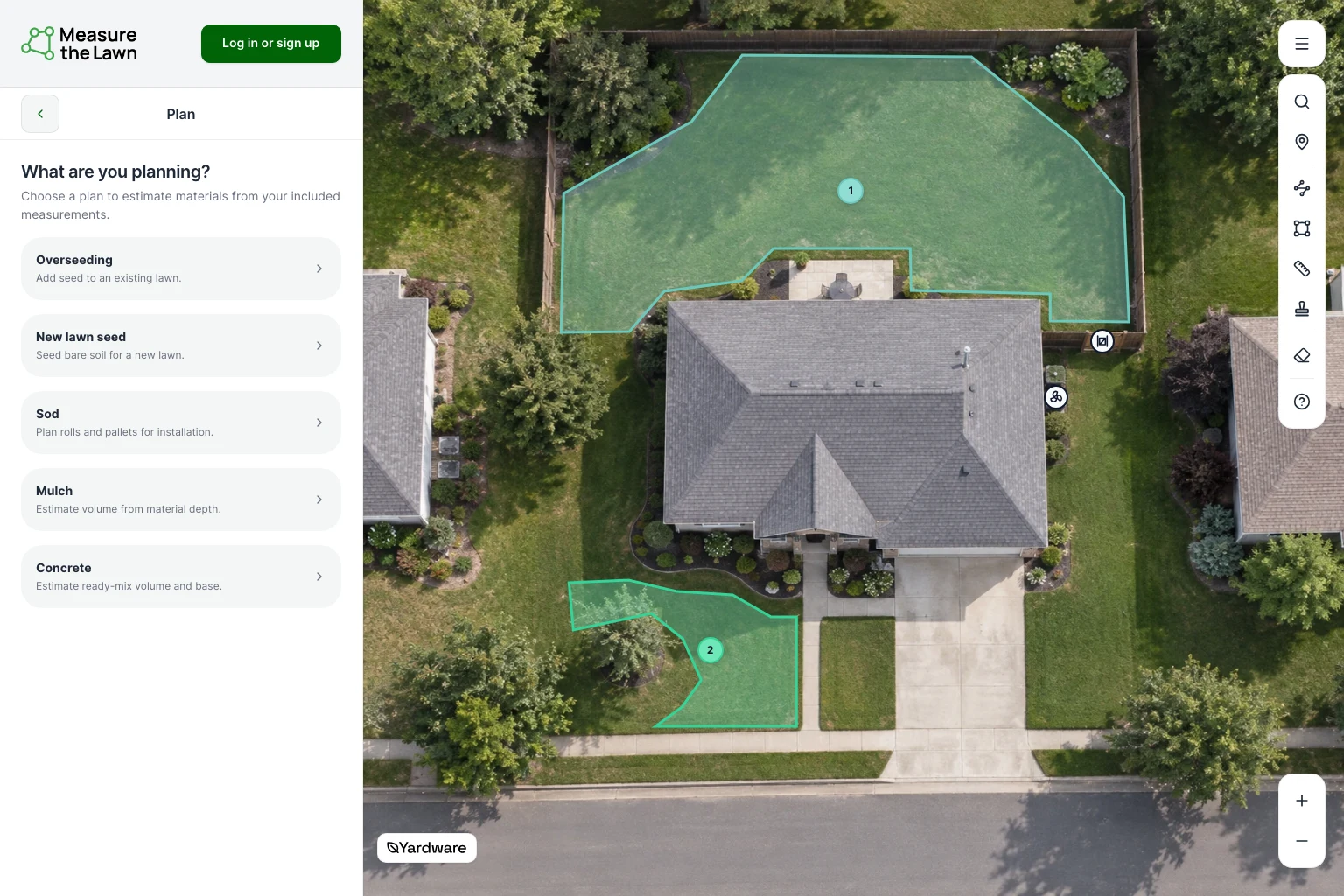
- Overseeding, new lawn seed, or sod: choose What are you planning? on the map to estimate how much to buy. Include only the lawn sections you’ll seed or cover with sod.
- Mulch or concrete: measure the planting bed, patio, or slab separately. Choose its map plan and enter the depth or thickness.
- Lawn mowing jobs: use the total for the lawn you’ll mow. If you’re pricing a service, also account for access, obstacles and cleanup in your lawn care quote.
- Retaining walls: use Distance for a straight wall run. Bring that length and the planned height to the separate retaining-wall calculator.
Check the Plan’s Included measurements and match Material settings to your product or supplier. Hiding a measurement from map results doesn’t change which areas a Plan uses.
Open Also plan for for supporting supplies where available. Optional supplies stay optional.
Measurement questions

Save the property for next time
Keep your measurements, Marks and material plans in a Yardware account. Use Save on the map and follow the prompts. Wait for Saved before leaving—creating an account alone doesn’t save your measurements.